


 55 / 84

55
SAMC
o
T
• ANNUAL REPORT 2015
Iceberg detection and monitoring using an
AUV equipped with multibeam sonar
PhD candidate Petter Norgren’s research on iceberg detec-
tion and monitoring using an AUV equipped with multibeam
sonar aims at developingmethods for autonomously detect-
ing and mapping an iceberg under the influence of wind and
ocean currents. One of the main challenges when mapping
icebergs from the underside is the unknown rotation.
While it is possible to measure the linear translation of the
iceberg using an upward-looking Acoustic Doppler Current
Profiler (ADCP), it is not possible to measure the rotation
of the iceberg. Therefore, the algorithm developed detects
and follows the edge of the iceberg, eliminating the need
to know the rotation of the iceberg in the mapping phase.
This research was presented at the POAC conference in
Trondheim in June 2015.
Due to warping of the collected data as a result of trans
lation and rotation, an estimate of the rotational speed of the
iceberg would be desirable if the data are to be processed
on board the AUV. Therefore, one of the research objec-
tives for 2016 will be to develop a method for estimating the
rotation of the iceberg in real-time.
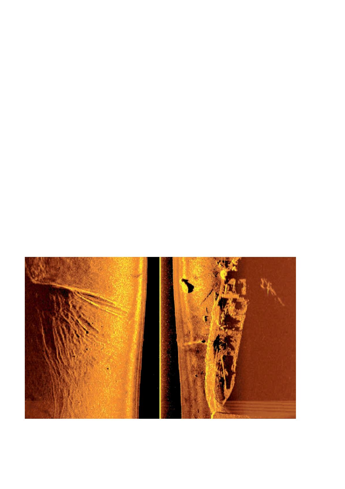
Field campaign: Northernmost shipwreck mapped with
AUV and remotely-operated underwater vehicle (ROV)
Figure WP5_14 Sidescan sonar image of the shipwreck.
In the period between August 31st and September 6th,
Norgren participated as a field assistant on the UNIS
course AT334 that, in addition to teaching students about
marine Arctic operations, also included underwater robot-
ics and underwater archaeological surveys. During the
course, a survey was conducted in Tryghamna, close to
the inlet of Isfjorden, where a previous multibeam survey
indicated a high probability of an unmapped shipwreck.
The NTNU REMUS 100 AUV was first used to verify the
position and presence of a shipwreck by mapping the area
with sidescan sonar, before a small-size ROV was used to
capture video images of the shipwreck. Further informa-
tion about the finding can be found at:
http://www.nrk.no/troms/har-funne-det-nordlegaste-skipsvrak-i-verda_-
_-dette-er-berre-starten-1.12560855
. A side scan image
of the shipwreck can be seen in the Figure WP5_14.
In addition to the survey in Tryghamna, several surveys
were conducted in Adventsfjorden in an attempt to uncover
more objects of interest. None was found, but the mapping
of Adventsfjorden will continue next time AT334 is held.
A picture of the REMUS 100 AUV in Adventsfjorden can
be seen below, with KNM Thor Heyerdahl seen in the
background.