
51
Annual Report 2016
SAMCoT
Three PhD candidates linked to SAMCoT have visited
the North Pole on board a research cruise to improve
their understanding of the use of ice surveillance
techniques for IM. The six-week-long research cruise
was conducted as a collaboration between the Swedish
Polar Research Secretariat (SPRS, a SAMCoT member
since 2015), the Canadian government and the icebrea-
ker Louis S. St-Laurent. The icebreaker Oden departed
from Longyearbyen, Svalbard, on August 8 to meet up
with the Canadian icebreaker Louis S. St-Laurent and
subsequently launch the expedition. During the six-week
expedition, the vessels operated in the Amundsen Basin
and in areas around the underwater mountain ranges
Lomonosov Ridge and Alpha Ridge. The primary goal
was to allow the Canadian government to collect infor-
mation about the seafloor in the Arctic Ocean in support
of the country’s application to the United Nations
(UN) to extend the limits of its Continental Shelf. This
included mapping of the seafloor using seismic surveys,
dredging, scanning by multibeam echo sounder, taking
sediment core samples and more.
SAMCoT PhD candidates Jon Bjørnø, Runa Skarbø and
Hans-Martin Heyn (Skarbø and Heyn linked respectively
to the Centre for Research-based Innovation CIRFA –
Centre for Integrated Remote Sensing and Forecasting
for Arctic Operations and SFF AMOS – Centre for
Autonomous Marine Operations and Systems) joined the
expedition to perform sea-ice data acquisition related
to IM and ice surveillance. Their work aims to improve
autonomy in Arctic marine operations through the
development of algorithms for the online or real-time
tracking and prediction of important ice parameters
such as sea-ice drift and loads on vessels, ice concen-
tration and floe size distribution.
During the expedition, the team tested a system to
monitor ice drift around the SPRS Icebreaker Oden, as
well as a camera system that monitored ice conditions
and thicknesses around the ship and a system that
measured vibrations in Oden caused by its passage
through the ice.
ARCTIC OCEAN 2016 EXPEDITION
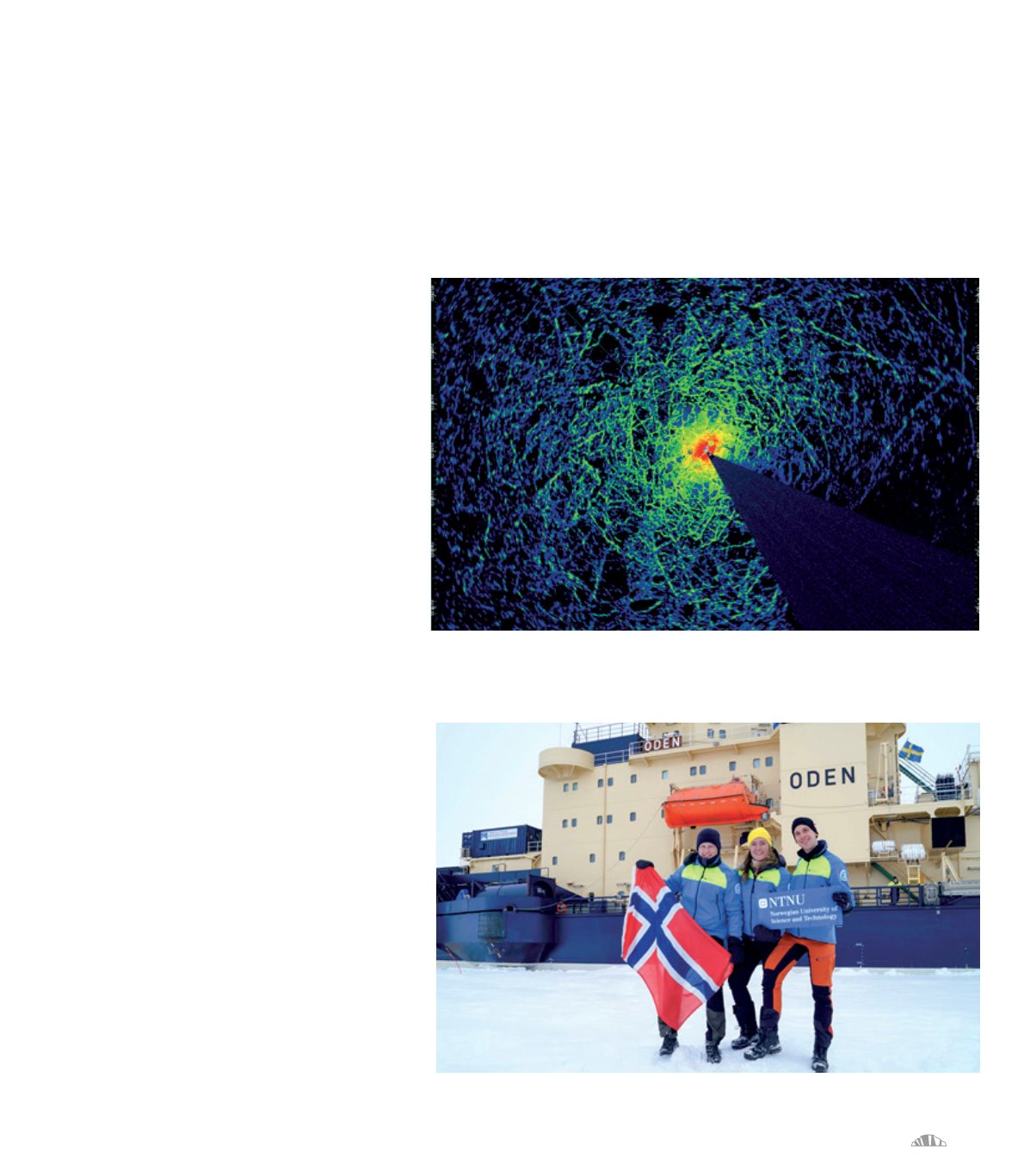
Example of a radar screenshot (resolution of 1920x1200 pixels, sampled at 1 Hz) in an ice management operation.
As part of her work, Skarbø collected screenshots of
the radar operator station at selected locations when
the vessel was stationary or drifting for more than four
hours. A sequence of such radar screenshots combined
with ship position reference and gyro-compass measu-
rements can be fused with a computer vision algorithm
to estimate accurately the sea-ice drift pattern in a
range of 0.5 to 6 nautical miles around the vessel. This
function, previously only achieved by manually deploy-
ing GPS trackers onto the sea-ice, is very important for
safe and efficient IM operations where understanding
ice drift and especially changes in ice drift is a critical
monitoring parameter.
SAMCoT PhD candidates Bjørnø, Skarbø
and Heyn at the North Pole, 21 August 2016


